
Land Surveying, Land Mapping Since 1993
Land Surveying Services
| PROVIDED FOR: | ||
|---|---|---|
| Public Agencies | Developers | |
| Civil Engineering Firms | Photogrammetrist | |
| Mining Operations | Law Firms | |
| Property Owners | Contractors | |
| Utility Agencies | Title Companies |
Hillwig - Goodrow Land Surveying And Mapping...
Technology Meets Family Values;
Family Owned & Operated
LAND SURVEYING & LAND MAPPING :
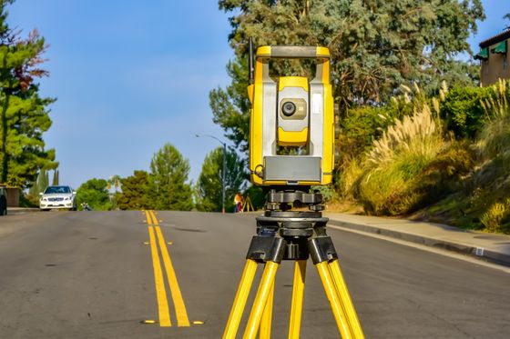
Professional Land surveying encompasses a number of techniques, incorporating many skills both artistic & scientific, gathering points on land surface, distances & angles to determine boundaries of ownership and for mapping purposes. Often land surveying is used to determine legal information for structural building & construction, to determine land ownership boundaries for property sales, or for purposes required by government or civil law. Therefore it is of utmost importance, you can count on experienced, skilled, professional land surveyors & civil engineers to complete work accurately.
At
Hillwig-Goodrow Land Surveying & Mapping, you will find the most well-respected land surveying technicians using state-of-the art equipment and having equipped themselves with all the continued education in up-to-date techniques of land surveying & mapping including Boundary Surveys, Control Surveys for Aerial Mapping, Land Divisions, ALTA/ACSM Surveys & Mapping, Topographic Surveys, Construction Staking, Precise Leveling, Expert Testimony, Flood Insurance Surveys & Elevation Certificates.
SERVICES
We provide all things Land Surveying!
- Land Surveying
- Boundary Surveys
- Topographic Surveys
- Construction Stake-Out
- As-Built Surveys
- Anchor Bolt location surveys
- Right of Way acquisitions
- Easement determinations
Our Method is the most accurate and reliable. How? We control precision by using static control first to ensure true readings, rather than trying methods where results may vary and there is need to redo the original effort. We never cut corners in attempt to save time. Our clients count on us to provide the best most accurate surveys in a cost effective and timely manner. We service the public sector, as well as engineers, architects, attorneys, real estate professionals, and contractors in Redlands, Yucaipa and throughout California, Nevada, and Arizona.
Hillwig-Goodrow Land Surveyors
HILLWIG-GOODROW began in 1993, providing GPS and conventional surveying services throughout Southern California. Our philosophy is based upon very basic principles - Provide professional, courteous, and timely service at a fair and reasonable cost. This philosophy has been the reason for our steady growth from a two man partnership to a staff of 14, capable of dispatching six survey crews.
Trust is the foundation of great service
We have the knowhow and skills to keep us on schedual and within budget. Our qualified staff keeps us reliable and accurate by utilizing the most precise and true methods of surveying. We take great pride in all we do, striving to provide you with the most accurate information possible, and walk you through everything in a clear and concise manner so you can be most confident in our results.

MENU
GET IN TOUCH
(909) 794-2673
hg@hillwig-goodrow.com
31419 Outer Hwy 10
Redlands, CA 92373
STAY CONNECTED
Business Hours
- Mon - Fri
- -
- Sat - Sun
- Closed